
Ostriches, Movie sets, and Aqueducts
- Savannah Robinson
- May 15, 2021
- 10 min read
Days 30 - 36
May 10 - 16, 2021
Miles 415.1 - 541.5

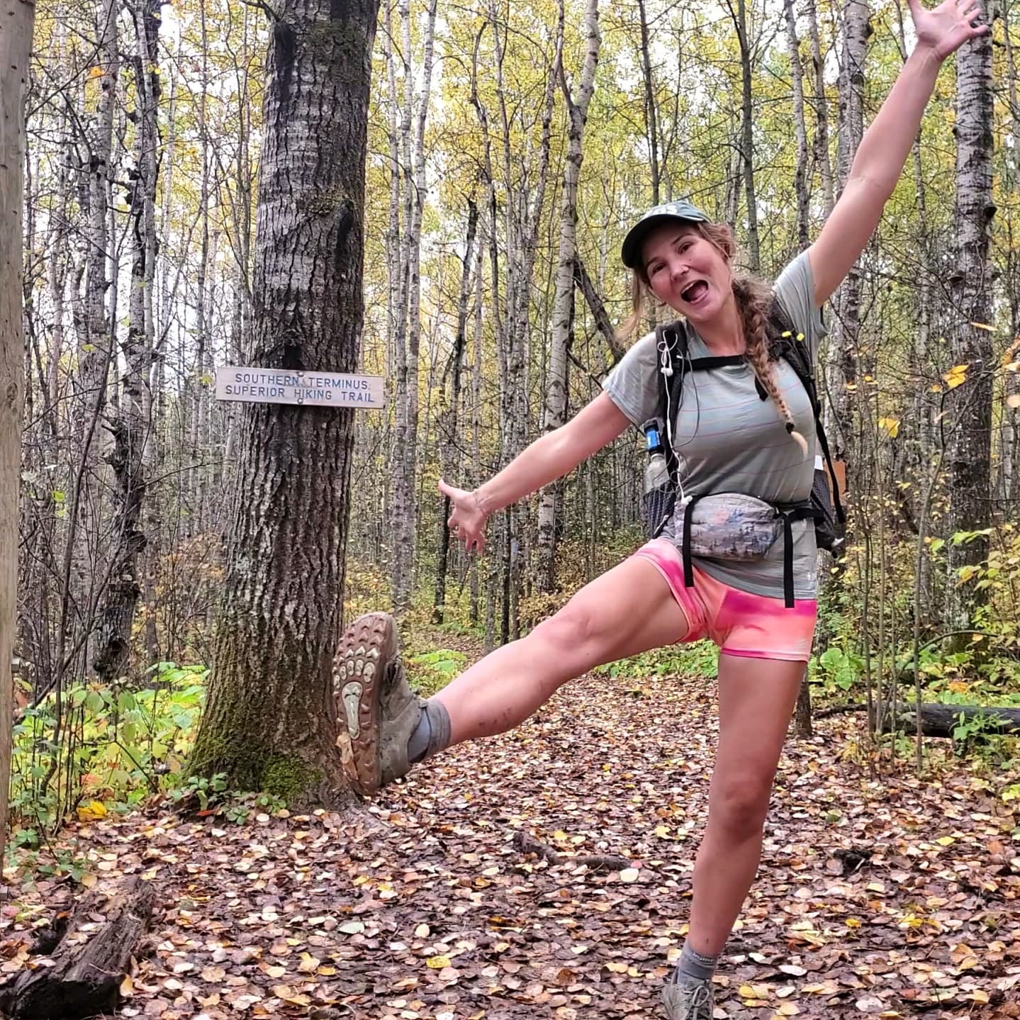
We had scheduled a ride out of town, but it wasn't until 11am so I got to sleep in. I spent the morning packing and writing letters and postcards. Mango and I got breakfast together before we headed over to the post office to send out our mail. Our ride came and drove us about an hour to the Three Points trailhead. A section of trail just outside of Wrightwood up to this trailhead was closed due to a recent fire. The US Forest Service closed the trial to keep people safe and prevent further damage to the sensitive ecosystem. I didn't want to drive and skip these miles in a car, but the alternative was to road walk. This highway had just opened up after being closed (the reason why no cars were coming our way the other day when we tried to hitch into town yesterday) and there wasn't much of a shoulder to speak of. Getting hit by a car on a narrow, winding mountain highway wasn't the way I'd want to be taken out by this trail, so we elected to get a ride to where we could legally hike on the PCT again.

The trail was easy and short today. We only hiked for about five hours before stopping for the evening. The following day marked one full month on trail for me! It has somehow felt like no time had passed at all and like I have been doing this for a long time. Being out here on trail just felt so natural and straightforward.
The trail today passed through the overgrown section. I added quite a few new scratches to my legs passing through all of the chamise and other chaparral plants that are growing in over the trail. We made it to North Fork Saddle, a US Forest Service picnic area. There was a Trail Angel set up there with a bunch of camping chairs and chips and ice cold sodas for a small donation. We hung out with him in the shade and chatted, enjoying our ice pops and drinks. A big rattlesnake made its way toward and around us. It was really beautiful to watch weave across the forest floor. We set up camp for the night in some of the designated campsite areas. It was a luxury to get to eat dinner at a table while on trail. We met Shame, a thru hiker and comedian who did some stand up for us. I love stand up comedy and thought he was hilarious.

I woke up in the middle of the night thinking it was raining, but it was the buzz of the large powerlines overhead. I used the vault toilet in the morning and regretted it, but unfortunately I was already committed. It was absolutely toxic in there and I ran out as soon as possible. Beware. About eight miles of downhill hiking took us to the Acton KOA. We got to hang out here and relax for the better part of the day. I had a replacement sleeping pad and resupply package sent here and spent some time sorting out my food. My best friend also sent me a secret message that I had fun decoding. Before I left, I told her she needed to send me puzzles as I feared my brain would atrophy without higher mental stimulation while I was out here. Another friend sent me some problems in binary that took me much longer to understand and work out. True heroes.

We spent several hours relaxing at the KOA. It was hot, but the store had cold drinks and ice cream, and the grassy lawn was shaded by trees and tarps. There was also a pool that kept us preoccupied for a while. It was a lot of fun and it felt like a summer day from my childhood. By mid afternoon, a bunch of other hikers had trickled in and it was starting to feel crowded. We packed up our stuff and continued hiking for another ten miles. It was still hot and the wind made using my sun umbrella too challenging to be worth it. But the trail took us through Vasquez Rocks as the sun was setting. This famous area has been used in a number of films, tv shows, and music videos. It was so cool to walk through this area of unique rock formations, and easy to see why its beauty made it on to the big screen so often.

We walked another mile and a half into the small town of Agua Dulce, getting there just before dark. After filling our bottles with clean water from a spigot hikers were free to use, we set up our tents in a large empty lot, ate dinner, and went to sleep.
The next day was my biggest mile day yet at 24, and I felt really good. It began with a road walk out of Agua Dulce and then about a 1,700ft elevation climb over four miles. We saw some coyotes running down the hill in front of us. It was a hot day, but with little wind so it was a great day to use my sun umbrella. We took a short break at the top of the climb, and then I continued on ahead of the guys. I made it to a bench along the trail under a large oak tree. It was nice and shady so I took a break for lunch and then a nap there. It was so lovely and one of my new favorite spots on the whole trail. I stayed so long that I actually got cold, a truly marvelous feeling in this desert heat.

Then it was another couple hours to the Green Valley Fire Station where we could use a spigot to fill our water. It was just Sorority Steve, Bushwhack, and myself as the others camped a little farther back. We set up camp and then the boys took a hitch to a market just down the road for some goodies. I stayed behind and watched our stuff.
I felt really good, a little sore after a full day of hiking, but strong. While I was loving being out here and constantly enamored with how beautiful it has all been, I was also beginning to feel excited to get out of the desert. We were well over halfway done with the desert section of the PCT and I was ready to put this dry, sandy, hot section behind me.
The following day was a relatively short day into Lake Hughes. We hiked the 7.5 miles from our campsite to the Lake Hughes Rd and then turned right from the trail to walk along the road into the small town. The trail was closed from that point due to another wildfire burn zone, so we had to walk the road around it. We stopped in Lake Hughes and went to the Rock Inn for some food. The guys and I hung out together until the rest of our crew showed up and then we all ate more food. I can't express how much hungrier I am now and how food is one of the four things I think about all day. I got to call my oldest brother for his birthday before we started hiking again.

We weren't going far. A couple miles up the road was Quail Run Ranch, an ostrich farm that welcomed hikers to camp on their property for a small fee. It was a really cool spot and we learned a lot about ostriches. We got to interact with the juveniles. Apparently the adults are too aggressive to be around, but the young ones are still gentle and curious. The ranch owners were very kind and so welcoming. They showed us how to let the birds nip our fingers. I never thought hiking the PCT would be the opportunity that allowed me to experience what it felt like to be bit by an ostrich.
Live your dreams. Experience new things. The world is great.
The place was set up really nice to accommodate hikers. They even had a charging port so we could charge our devices. A little pond on the property sang with frogs croaking. It was such an excellent spot and I am so glad we stayed here.
On the road walk into this place, I was messaging my best friend, Elizabeth. She had spent the day recording a song she had written for me and my hike. She had performed it for me before I had started hiking, and I asked her to send it to me so that I could listen to it on trail. I tell you Elizabeth is my best friend. She is really my heart and soul. I wish everyone could have a soulmate like her, but she is truly unmatched. There is no one as wonderful as she is, and I love and cherish her with my whole self. Down the Trail - Elizabeth Villano.
We woke up early the next morning and finished the rest of the road walk to avoid the fire closure. I spent most of the way walking with Mango. It had been a while since we got to hang out and talk, just us. It was really great to have that time together with her. While I love the guys so much, sometimes I needed a break from them for some time with other women. It was incredibly rejuvenating.
Along the road walk, I kept looking north to see if I could see any sign of the Neenach Volcano. This rock formation, or what's left of it, is half of the original volcano that formed here 23 million years ago. But it was split by the San Andreas Fault Zone. The eastern side, Neenach, remained here while the western side has been pulled by plate tectonic activity about 195 miles north. The western portion lies in Pinnacles National Park, a couple hours south of the SF Bay Area and where I lived and worked for a year. I thought it would be really neat to see her sister formation, but alas, I wasn't able to see it despite my efforts.

Somewhere in the fire closure that we were walking around, was the 500 mile marker. So when the road rejoined the trail, we stopped to celebrate our 500-ish mile achievement. Obviously, we danced and played I'm Gonna Be (500 miles) by The Proclaimers. It was so fun and I am glad we still found a way to celebrate, despite the fire closure.
A few more hours of hiking brought us into Hikertown around noon. This funky hostel out in the middle of the desert is an important stop for hikers as it marks the beginning of the Los Angeles Aqueduct section. The owners provide some food, faucets to fill up on water, and a place to sleep, in the form of separate little cabins that make up what feels like a whole town set in the Wild West. I stayed in the "Doctor's Office." I felt like an extra in a old western movie.


The owners made everyone a big spaghetti lunch. Then a few of us got a ride to Weevil Market to grab some food supplies. We ended up staying there much longer than expected as our ride arrived to pick us up much later than promised. At first it was fun and I went with it, but for the last half hour I was feeling anxious and just wanted to be back with my stuff where I could relax. When we finally got back, I made dinner and hung out with all the other hikers staying there that night. Then I went to bed because we had a real early start the next morning.
I woke up at 4am to get packed and ready, and hiked out with Mango, Slice, and Redline at 4:30am. The others were going to wait until the evening to night hike this section to avoid the heat. We had checked the forecast and weren't so worried about the temperature, just enough to get an early pre dawn start.

It was completely dark out so we hiked by headlamp. The trail was easy to follow though as it quickly began tracing the LA aqueduct, first a wide, open channel of water that then disappeared into a large metal pipe. This water is taken from the Owens River on the eastern side of the Sierra Nevada and delivered to the city of Los Angeles. The PCT builders were unable to gain permission from the landowners to put the trail along the nearby mountains, so the trail followed this straight, flat, boring, exposed, and ironically waterless (the water is inaccessible in the large pipe) aqueduct for 17 miles instead.
That early in the morning, the stars were out and the deep blue sky was so beautiful. There were so many sparkling stars and I was able to see the Milky Way. And since everything was so flat and there a few clouds, the whole sky lit up so gloriously and fully with the early morning pinks of dawn, quickly followed by the golden oranges of the sunrise.

Once the sun had risen properly and the color show was over, it didn't take long for the monotony of the LA aqueduct to get to me. It was just a hardpacked dirt road with nothing on either side. The repetitive footfall of the unchanging tread caused my right shin to ache in protest. This was a good day for the audiobook as there was really nothing else to do, but pray it went by faster.

We took a break at the water faucet. This was a completely nonfunctional faucet, but there was a small shed there that provided some form of location marker that drew people to it. From about there, the trail leaves the aqueduct and begins an ascent back up into the mountains. I can't say I enjoyed that too much as I was in a bit of a sour mood from the pain in my shin from the tedious aqueduct walk.
It became incredibly windy as I got further up into the mountains. We got to Tylerhorse Canyon, the first place we could legally camp and the first source of water. The wind wasn't any better here, but we did our best to set up our tents. Some other people were also setting up tents, while others were just taking a break before they continued on their "49 mile challenge" attempts. It is 49 miles from Hikertown to Tehachapi, and some people try it all in one day. I had thought about it, but my shin was screaming and I just wanted to collapse in my tent. I couldn't imagine being only halfway done with my day at that point.


Comments